

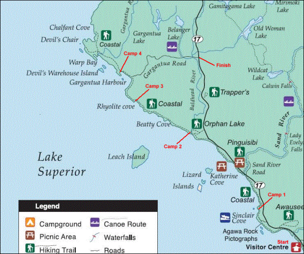
LAKE SUPERIOR PROVINCIAL PARK
Summary
The Coastal Trail follows the east side of Lake Superior in Lake Superior Provincial Park. The recommended hiking time is 5-7 days. The terrain varies from forested flat sections, sandy coves, boulder beaches, boulder gardens, river crossings, granite slabs, caves, and exposed cliffs. Now I don’t consider myself a super hiker but I would classify this trail as very rugged/strenuous and definitely not for a novice hiker.
Day #1 (April 28th)
Hiking Time: 6 hours
Distance: 14.4 km (9 miles)
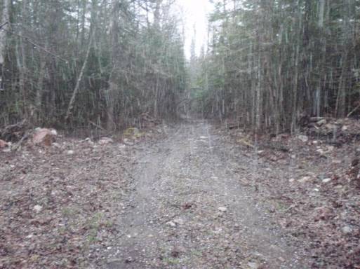
After about 10 hours and 950 km (590 miles) of driving, I pulled into the parking lot to the park. Cell phone coverage stopped a few hours ago and all the trucks have big bush bars on the front of their grills. I head inside and grab my permit. The park doesn’t officially open for a few days so I only have to pay for 2 nights (19 bucks). The trail is officially 62.9 km long, but you have to backtrack 10.2 km along the trail to get to the parking lot at the end of the road leading to the trailhead. The park ranger informs me that the road is actually closed because of the amount of snow on the road so I have to hike it adding another 14 km to my trip. The trail is also linear, and the ranger offers to shuttle my car from my start point to the end of the road…a really nice gesture.
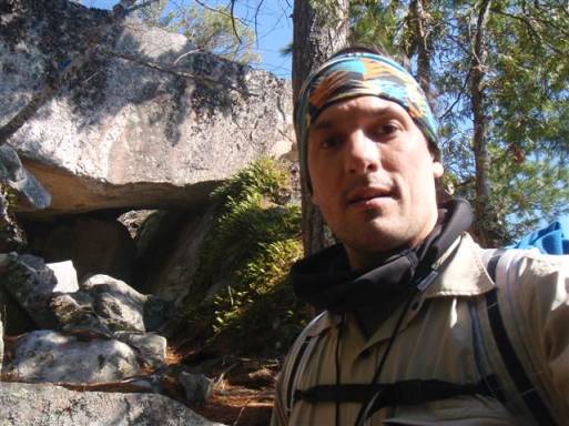
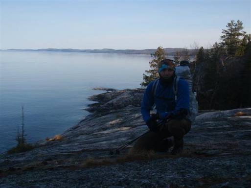
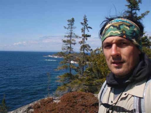
I park my car at the visitor center and hide the key under my bumper for the ranger to shuttle sometime during the week. The weather is a cool 7*C and I head off from the south end of the trail at 12:30 pm.
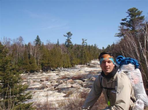
The trail is an easy stroll along fairly flat terrain for the first hour or so. It heads up to the road to cross a big river and then back to the coast.
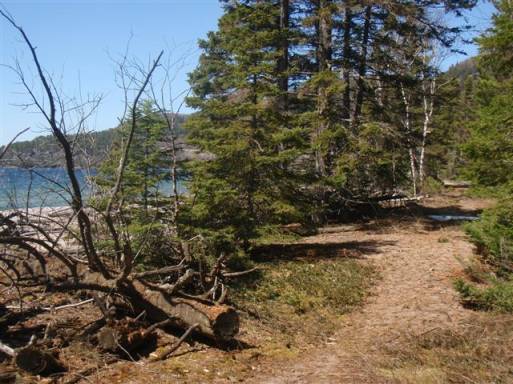
At this point, the trail begins to becomes a bit more difficult to navigate. The rock beaches and boulders begin to show themselves.
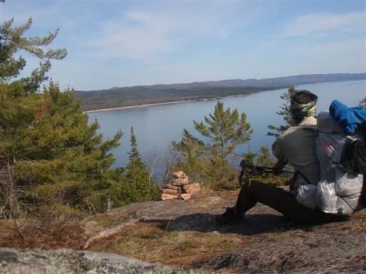
I’m a few hours in and I decide to stop for a late lunch at a campsite that I came across. The view is quite pleasant but the cool breeze coming off the lake reminds me to take advantage of the nice weather and keep hiking. I stop for only about 30 minutes. I have an interesting encounter with an otter that decided to visit me during lunch, and am back on the trail.
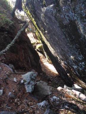
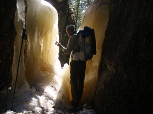
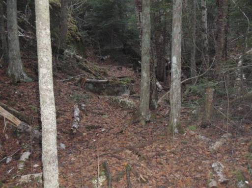
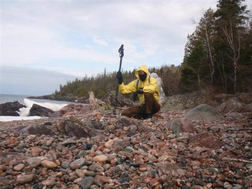
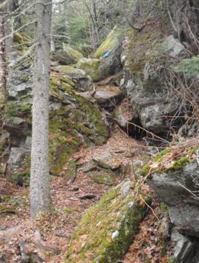
The trail heads along the coast in and out of the forest. In the forest, one must navigate giant boulders. Climbing over, under, and sometimes through cracks and holes are required. The scenery is stunning, but the moss and dampness of the fauna eventually wet my clothes. The crack pictured below was a real squeeze…and the angle of the crack didn’t make it any easier. You can see the blue trail marker on the other side.
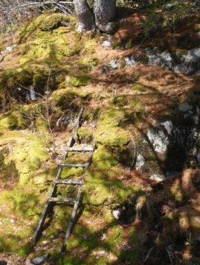
It seems that the ladders either aren’t maintained or aren’t supposed to be used anymore…I didn’t bother taking my chances with this one.
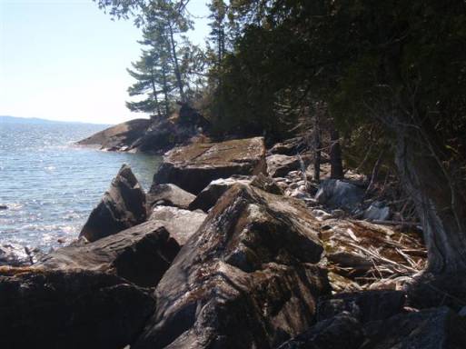
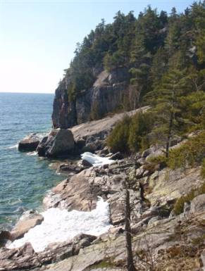
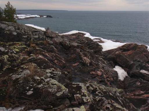
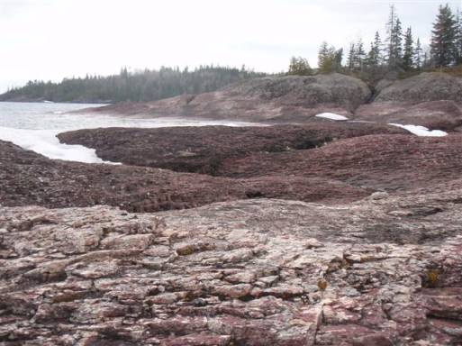
Pushing along out of the forest, the trail sends me back out to the rocky coastline. Already I am feeling the wrath of these rocks. Balancing on them is difficult, travel is slow, and a sprained ankle seems almost inevitable. The temperature is warm but the wind cuts through all my layers. You can see that there is still snow lingering on the trail.
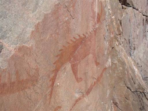
The Ranger had told me to make the side trip to see the Aboriginal Pictographs. I figured I couldn’t pass up the opportunity considering how far I traveled to be here. When I come to the side trail, I hike up the incline only to find the trail blocked by ice. I am seriously bummed out at this point. You are probably wondering why I didn’t just climb through the crack between the ice? You should have seen the other side…a little too steep for my liking!
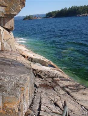
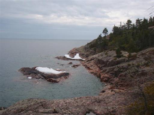
Luckily, about 30 minutes later I am surprised to find that the trail to the pictographs is actually a loop and the other side isn’t blocked! I make my way down to Agawa Rock to see the pictographs. The pictographs are located on the side of a cliff face and the slanted rocks leading into the chilly waters are outfitted with chains and ropes to reduce the chances of going for an unwanted swim.
I had to conserve my camera battery so I only took a couple of shots of the pictographs. This one turned out the nicest…it isn’t easy snapping photos on those rocks!
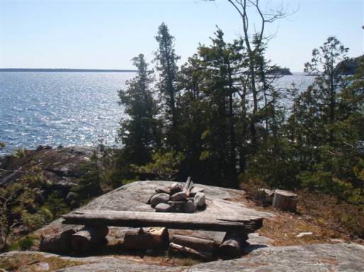
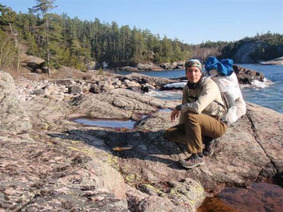
I make it to camp before dark and set up in a nice little cove. I have a view of a nice rock beach, a calm inlet, and off in the distance is Barrett Island. A nice hot dinner and I’m in bed by 10pm.
Day #2 (April 29th)
Hiking Time: 9.5 hours
Distance: 20.25 km (12.5 miles)
Last night dropped to about -3*C. I wasn’t freezing, but I wouldn’t have minded to be a little warmer up top. I had to stick my hands in my pants to keep them warm. No worries, once I got up in the morning and started moving around, things started to thaw out and warm up. I was on the trail by 8:30 am and ready to go. The early morning was still chilly so I had to bundle up.
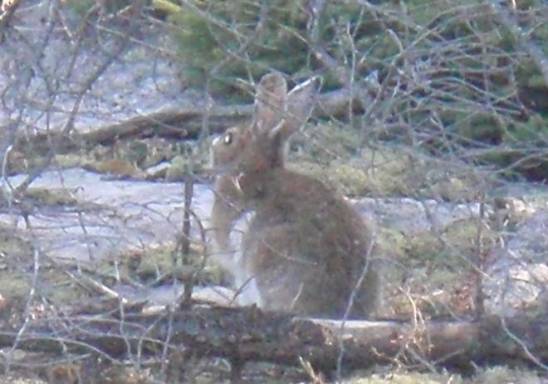
I figured the second day would be a breeze considering the lack of elevation on this section of the trail. There were some nice beach walks, but the boulder beaches were killing me. Miles an miles of basketball sized rocks…and lots of them were covered in moss so it made for a slippery hike. I would start cursing when I realized the trail was spitting me back out to the beach…and there was no sand! There were a few ridges throughout the day. On top of one of them, I spotted this little guy.
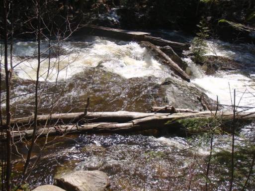
It really started to warm up throughout the day and by noon, it was roasting outside. This made for a nice time to dry out my feet and stuff from all the soakers I was getting crossing the rivers and streams. When I saw this crossing, I prayed there was a bridge…and of course there was.
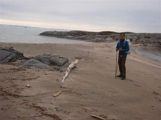
Just on the other side of this river was a beautiful beach. Walking on the sand was a dream compared to the rocks so I just strolled along. At the end of the beach, the trail darted back into the woods and I figured it would be a good time to stop for lunch and dry my stuff out. I looked at my thermometer and it was reading 28*C…wow, a 31* difference from last night.
A little over an hour later I was back on the trail and working my way north. The trail varied between sandy beaches, high ridges, and forested sections. All were equally stunning in their own way.
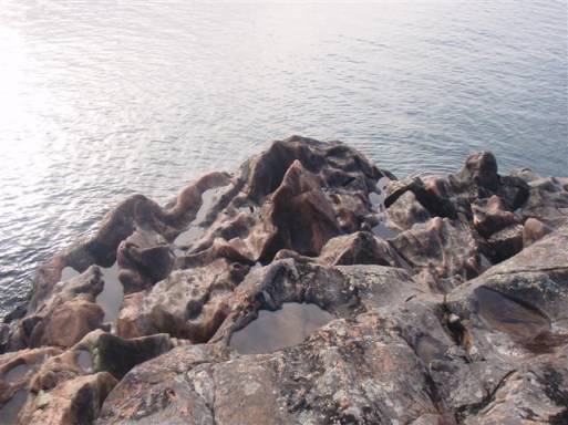
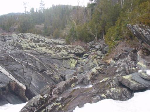
A few more miles on some rocky sections, which I was hating at this point, and I was well on my way to my campsite. The rock formations were quite spectacular in some sections due to the water beating away at it. Sometimes, even the jagged sections were well rounded out and a welcome characteristic on my sore feet.
The final push to camp was a big up and down called Bald Head after a rock beach walk. It was starting to rain a bit so I rushed to camp and set up. The rain held off for a bit but started up throughout the night. It poured pretty good but I kept relatively dry….except for one mishap. For some reason I always figured my Cuben Duomid came seam sealed…guess what, it doesn’t.
Day #3 (April 30th)
Hiking Time: 9 hours
Distance: 12.35 km (7.7 miles)
Last night I slept very warm. I didn’t get a chance to check the temp but I believe it was around 5*C which is not a problem for my sleep system. Also, for whatever reason, there was no condensation in my Duomid this morning – nice! I didn’t hit the trail until about 9:30am. I woke up at 8am but went back to bed to get another hour or so of sleep. It rained again throughout the night and was raining when I woke up. I bundled up with all my gear and began to hike. Of course, rock beaches right off the bat…ahhhhhh!
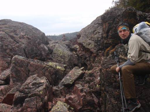
Today was the most technical and toughest day. There were lots of ups and downs, I got lost a number of times and had to go bushwhacking, and the coastline was super rugged. Some sections required some serious climbing to get by. I haven’t looked into it, but there must be tons of injuries here every year. I mean, some sections are really exposed, and with the rain you are literally reduced to crawling over these things as they become as slippery as ice – no exaggeration.
There were some beaches and a few rocky areas that were somewhat easier to traverse so I was thankful when I reached them.
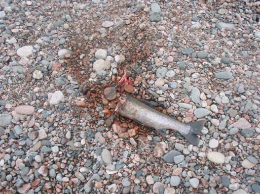
I found a bunch of hawks picking at this guy when I was crossing one of the streams. They weren’t happy when I walked by. I guess they thought I was going to eat it.
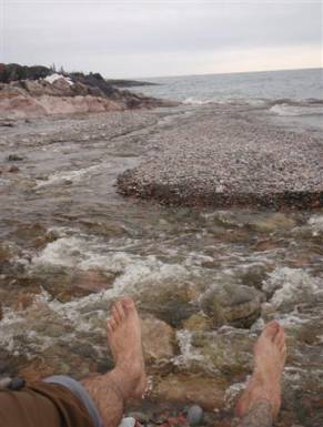
Drying my feet after yet another crossing. I took my shoes off this time as I was afraid the bad weather wouldn’t let me dry them out later on.
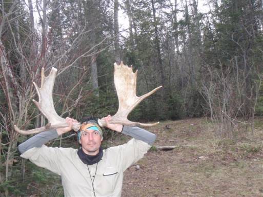
I reached camp and the weather was finally letting up. I collected some wood to have a fire and came across a moose rack. I’ve never seen that before. I was tempted to take one but figured best to “take only pictures” and “leave no trace”.
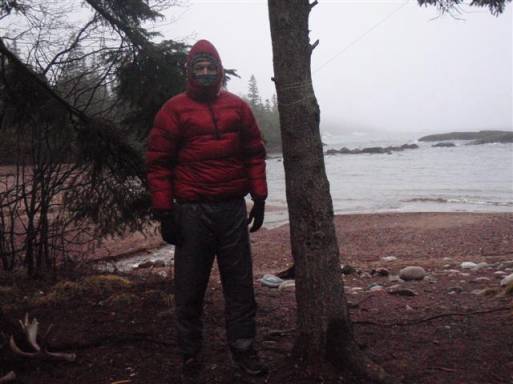
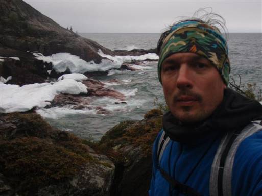
The temperature was dropping pretty fast and the rain started again. I set up my tent and put on my most stylish attire in case some trail babes stopped by. Don’t I look cool?
I like to keep a nice and tidy tent… Oh, and in case you are wondering why I have so many pieces of CCF. My feet were so wet and cold that I needed to make some camp sandals to dry them out in the evening so I cut up my torso pad and added some string.
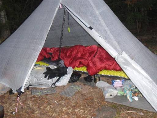
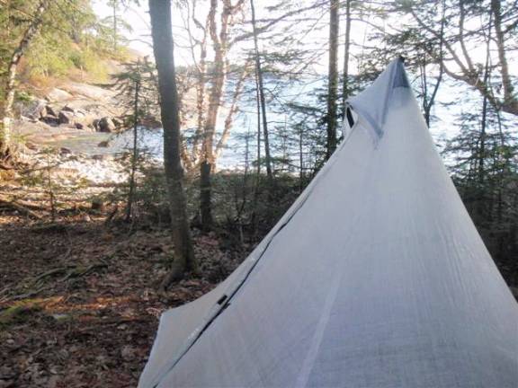
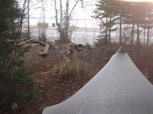
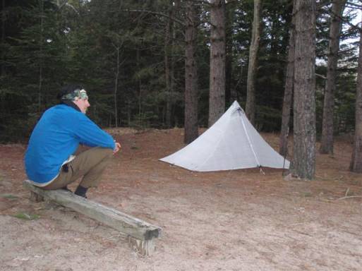
My camp for the night. It ended up absolutely pouring soon after I was all set up so I just sat in my tent. It didn’t let up and I ended up cooking in there aswell. I’m not sure if using esbit in a tent is good, but there was no way I was going out in a storm like that.
Day #4 (May 1st)
Hiking Time: 10 hours
Distance: 24 km (15 miles)
I know that everyone has experienced there share of storms, but WOW, it was a doozy last night. It literally poured sheets of water all night. My tent was soaked from the outside from the rain, soaked from the inside because of condensation, and lots of my gear was wet from the rainsplash and the fact my tent was leaking like a faucet. It was only drizzling when I finally got out of my tent, but it was pretty nasty out by the time I got on the trail.
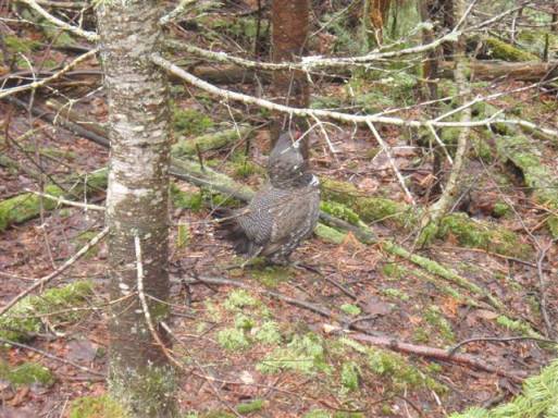
The first few hours were the same as yesterday. Lots of ups and downs and rocky sections. I came across a few animals today. One was this grouse just off to the side of the trail. These guys always end up scaring me.
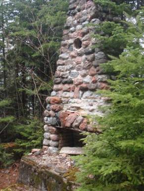
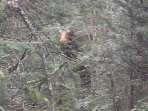
When I had finally made it to Gargantua Bay, there was an old chimney sitting off in the bush and I also had a moose encounter here. The moose was actually walking down the trail towards me. I spotted him quite a ways from me and tried to move off into the bush in hopes of getting a closer picture. Unfortunately, he must have spotted me and froze. I snapped a few pictures but as soon as I took a step towards him, he bolted into the woods.
At this point, I was at he start of Gargantua Road. At the end my car was “supposed” to be waiting for me (shuttled by the ranger). I briefly thought about heading to the car since I was pretty wet but thought of the embarrassment I would have to go through when I admitted I bailed for no real reason other then being a little wet. I pushed on.
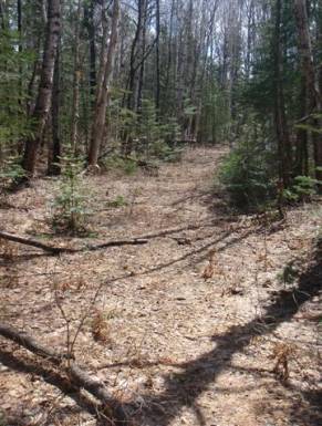
And good thing too…the terrain became very flat and the sun started to poke though the clouds. Maybe it would turn into a nice day?
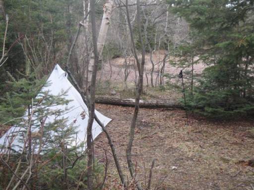
The sun did come out for a bit. It was nice to actually sweat and produce some heat. And the final 2-3 miles of the trail became rugged again, but nothing that was going to stop me now! Except maybe this bridge…I assume that the winter ice melt washed it away.
But before long, there were beautiful views from the ridges and the end was near.
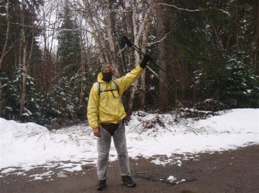
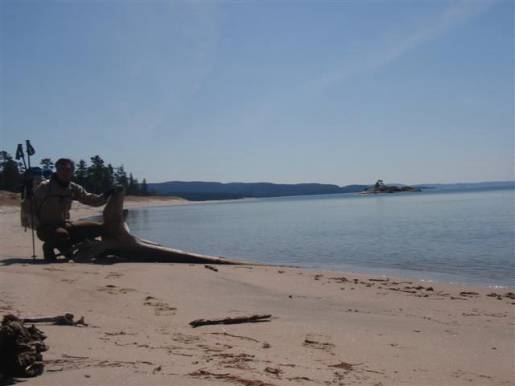
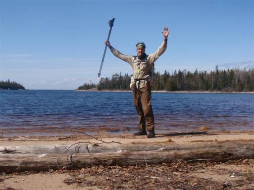
Finally, 4 days later, I reach Chalfant Cove which marks the end of the Coastal Trail. A lonely celebration takes place!
Now, I have to backtrack a bit, as my car is another 24km (15 miles) away still. So I put my head down and see how far I can make it before dark. The shorter my hike out tomorrow, the more energy I’ll have for the long drive home. I make it to camp at about 7pm. It is a in a beautiful bay and the campsite is great.
Since the evening ended up being so nice, I had a small fire and stayed up pretty late…11pm…yeah, I’m a party animal.
Day #5 (May 2nd)
Hiking Time: 4 hours
Distance: 16.1 km (10 miles)
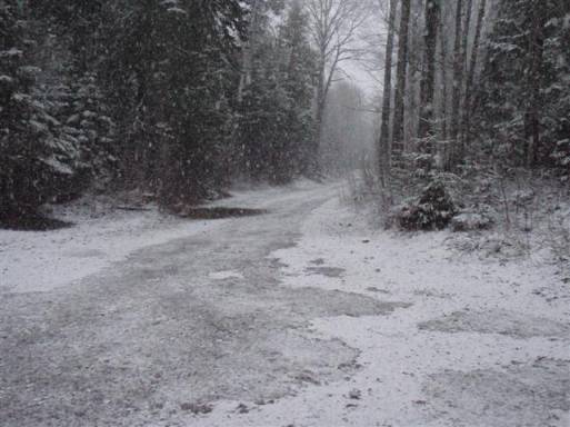
Well, I knew I wanted to get up early, but 5:30 was a bit earlier then I wanted to. Problem was, it was darn cold. No problem, I started packing up and was on the trail at 6:30am. But the weather wasn’t looking so good. A little snow started to fall. I dawned my rain gear and headed out.
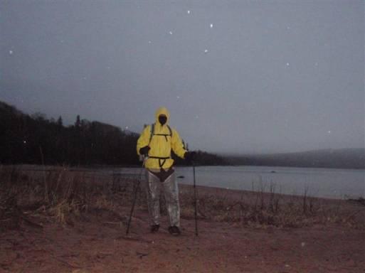
At first, I didn’t think much about the wet snow. I figured I would be at the car soon so who cares. But it started to come down really hard. In about an hour, it had turned this…
Into this…
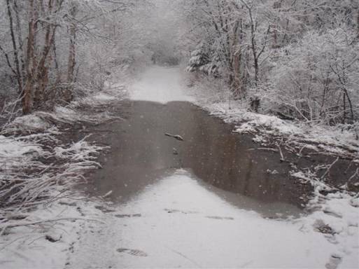
I came across a large washout out and couldn’t find a way around it. Not sure if I was thinking right, but I decided to run through it top speed and figured this would be the best route.
Shortly after, I was changing my socks under a tree. Why did I think that was going to be a good idea?
Then, I saw it. My car! I prayed my key was hidden under the bumper like we discussed.
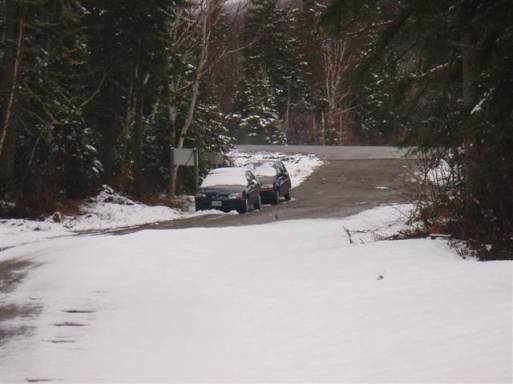
I wasn’t in the mood to hitchhike. I checked, and the key was there.