
ZION NATIONAL PARK
Summary
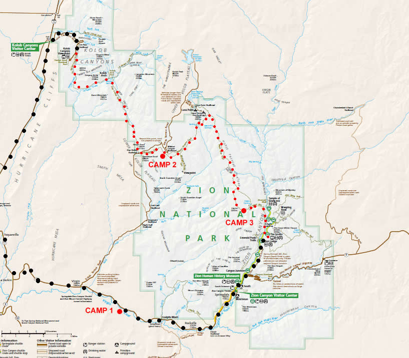
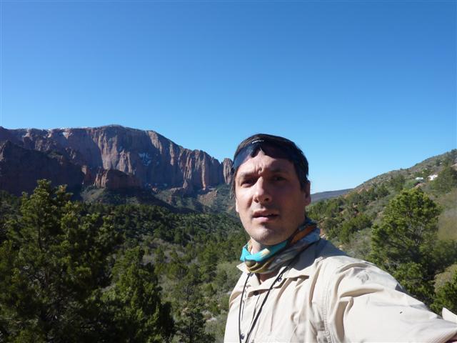
Zion National Park is located in Utah and consists of towering cliffs and narrow canyons. In order to fully expose myself to the park, I decided to hike a modified version of the Trans Zion Traverse. Typically, the traverse will begin at Lee’s Pass and end at the south end of the East Rim Trail. However, I was in a jam for time so instead of the East Rim Trail I opted to hike up and down Angels Landing and then out The Grotto, where my hike would end. Other then a few ups and downs, the terrain is fairly easy to cover and I would think any avid backpacker can pull this hike off. Maybe add a day or so as I was covering a lot of ground for the first 2 days.
Day #1 (May 15th)
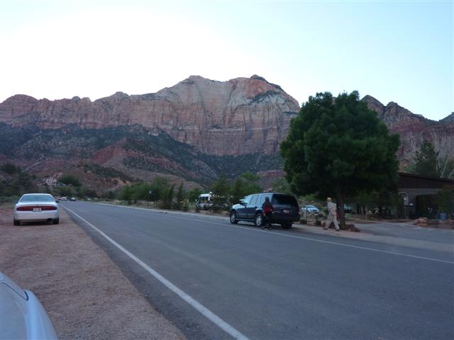
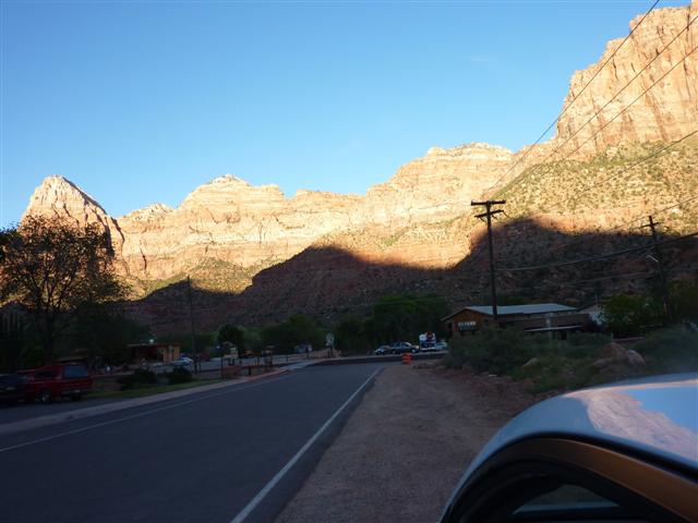
It all started on May 15th at 3:30 am when my alarm went off at home. I was all packed and got dropped off at the airport by 4am. My flight was at 6am and I just barely made it through customs with all my gear to catch my flight. I slept most of the flight and roughly 5 hours later I arrived in Las Vegas. A quick shuttle bus over to the car rental place where I had a sweet Nissan waiting for me. I loaded the car up and off I drove to Zion National Park which took nearly 3 hours. The scenery on the way there is unbelievable. I thought I was going to crash the car looking at it so much. I arrived at Zion around 6pm local time, and I was exhausted. I had a shuttle booked with the Zion Adventure Company for the next morning so I stopped by to check to make sure everything was a go. They were very friendly, gave me some advice on my route and recommended Oscars for dinner.
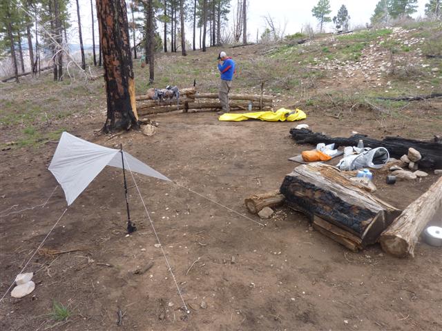
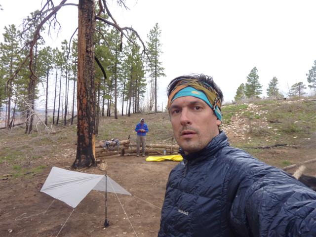
Having nothing else to do, I headed over to Oscars to grab a burger and a few beers. A couple of hours passed while I was there. I was sitting on the patio and the warm day was turning into a chilly evening. I decided to get some rest as I needed to be up early to grab the shuttle. I set up my tarp at the BLM and was in bed by 11pm.
Day #2 (May 16th)
Hiking Time: 9 hours
Distance: 26.2 km (16.3 miles)
I woke up at 4:30 am in a panic thinking that I had overslept. I realized I wasn’t going to be able to get any more rest so I decided to pack up and go to the public restrooms to clean up and prepare for the hike. A quick change of clothes, some last minute adjustments, and I was driving back to the Zion Adventure Company to grab my shuttle. I arrived about 1 ½ hours early so I just parked outside of the place and slept in my car for the remainder of the night.
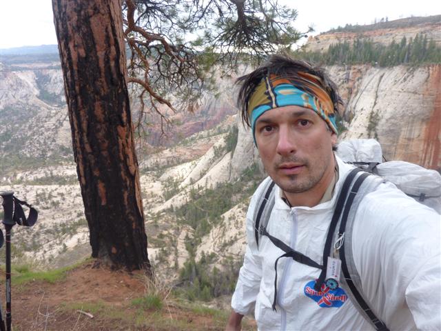
The shuttle pulled in at about 6:45am and people started to gather around. I got out and hopped on for my ride to Lee’s Pass. Almost immediately, people were questioning my small backpack and gear. I shared with them my philosophy of hiking light and they were very interested. So much so that I offered my gearlist to a Father and Daughter (Ali) group so they could go over it during their hike. They had just been experimenting with new techniques and had read some books on UL hiking – it won’t be long before they are fully converted! They were very nice people and I hope to hear from them in the future. The shuttle dropped me off at Lee’s Pass at roughly 9am and I was on the trail by 9:30am. The terrain here was going to be like nothing I had seen before.
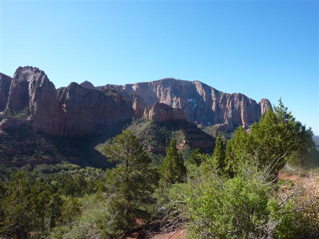
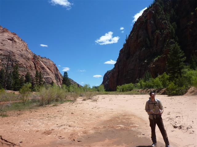
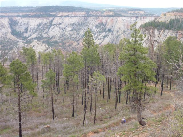
A very dry climate with towering cliffs and minimal foliage. I was loving it from the start. My original destination was to be campsite #10 along the La Verkin Creek Trail. Within 2 ½ hours I was at campsite #5 and decided to stop for a drink and a bite to eat. I was making good time, but knew there was no rush so thought it best to enjoy myself. The view from the campsite is simply awesome. A huge cliff sits behind you and a river runs in front.
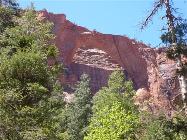
A few hikers passed and I decided to get back on the trail. Not long afterwards, I arrived at my designated campsite for the night, but it was so early in the day, I didn’t know what to do. I decided I would continue on to Kolob Arch and see what time I get back at. The hike to Kolob Arch from the main trail is a short one, maybe taking 20 minutes, but it well worth it. A small creek runs beside the trail and one needs to cross it a couple of times to get there. I actually spotted a very weird little frog stuck in a ridge on the rocks. He was all slimy and stuff but very different then the frogs we get up here. Kolob Arch eventually shows itself at the end of the trail and the viewing point has a massive tree right beside it. Believe it or not, I was impressed by both the Arch and the Tree.
I had heard that if you hiked closer to the Arch, there were a couple of nice waterfalls to see, but I saw no sign of a trail and I wasn’t about to go off trail to find it. Once back on the main trail, I met another hiker who was staying at Horsecamp C and I thought that would be a better option based on how early the day was. We set off to go together and the trail immediately turns into a large climb up. This trail is the Hop Valley Trail and brings you into the bottom of the Valley where the trail continues.
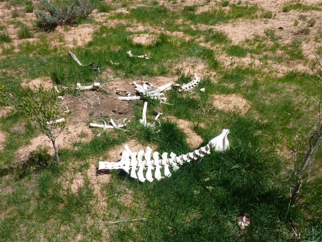
Once again, I made it to the camp in good time and decided to push on. It was at this point where I made a little mistake. There was not to be any water available, according to the map, until I got to Wildcat Canyon. I figured I had about 2 liters on me and that would serve me well for the rest of the day…how wrong I was. The hike follows the valley with large cliffs on each side. You cross a private ranch of some sort and are required to actually open a gate to enter and another to leave. Make sure you close the gate so the animals don’t get out! Actually, I didn’t see any of the cattle, except for the remaining bones of a dead one. At least I think it was from them.
Once passed the ranch, the area becomes very dry and sandy. It was at this point where my water level was nearing nothing and I started to realize that there wasn’t any on the trail for quite some time. I took a quick look at the map and saw that there was a parking lot at the end of the Hop Valley Trail. I thought maybe there would be public toilets where I could fill up and then just stealth camp for the night as it was getting late and I was starting to run out of energy. When I arrived at the parking lot, there was indeed a bathroom, but it was a composting toilet with no water. I sat down to re-evaluate the situation. I cursed at myself for being so stupid. Was I going to ruin my hike because I didn’t carry enough water. Figures the Canadian guy goes to the desert and dies of dehydration. While this was no emergency, I had never been in a situation without water like this. The map showed the next water source to be almost 10 miles away. I wasn’t sure I could make it. I figured it would be best to push tonight instead of tomorrow as temps would be cooler and I would need less water. So I pushed on. Once on the connector trail, I was starting to feel the wrath of my long day. I was up to 8 hours hiking by now and the heat really drained me. I’m not used to being blasted by the sun like this. And it is relentless…all day the sun beats down on you. Back where I come from, 5 liters of water would do me fine for drinking all day and meals…not here! About an hour later, I heard some water running. I looked over the edge and saw a creek down a small cliff. I had considered climbing down because at this point I was parched. I didn’t want to make a stupid decision and opted to hike the trail and push to the next water source. Then, out of nowhere, I descended a small hill and came across a raging creek. Eureka! Where did this come from? Looking at the map, it may be the small creek shown in the middle of the connector trail, but I guess since the snowmelt is so large this year, there is plenty. I found a secluded spot off trail, grabbed some water, and chugged a few liters. The water was almost red from all the sand in it, and I didn’t even care.
Funny how you think something is going terribly wrong and then all of a sudden, you are right back to normal. My site was nothing special, just a grassy hill and I slept like a baby!
Day #3 (May 17th)
Hiking Time: 10 hours
Distance: 25.1 km (15.6 miles)
I woke up at about 6:30 and waited for it to warm up a bit. A nice clear night meant there was minimal cleanup of the campsite, and I was on the trail by 7:30 am.
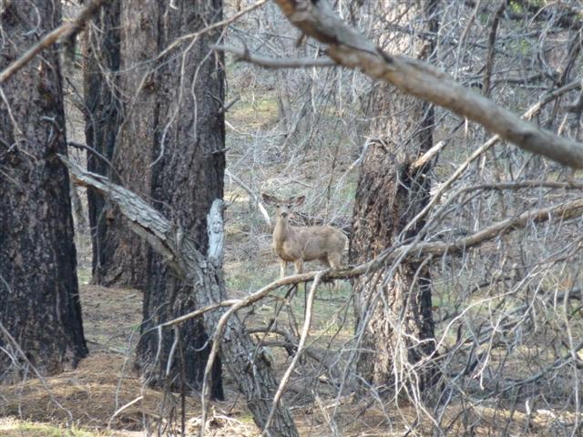
The early hours and wooded areas of the Connector Trail offered great deer sightings. I must have seen about 8 of them and they aren’t shy at all. They come as close as I would want them to come and pose for some nice shots.
Once on the Wildcat Canyon Trail, you essentially follow a small creek through a forest, up a large escarpment and then back down a ridged trail where you have to cross a creek. With the water levels being so high, the creek was flowing very fast. I managed to hop across a few logs to get to the other side, but I’m a tall guy so my stride is rather large. A couple behind me was having trouble and I offered to give them a hand by placing another log for them. They declined while I placed the log anyway. As I was collecting water, a larger group (maybe 8 people) came to the crossing and didn’t quite take a good look or test the new log I had just placed. Into the water the first three went. I wish I had that on camera…priceless. The trail then continued up for a while where a left takes you to the Lava Point Overlook and a right takes you to the West Rim Trail. The wind was really picking up at the top so I decided to have a rest, eat some food, and bundle up.
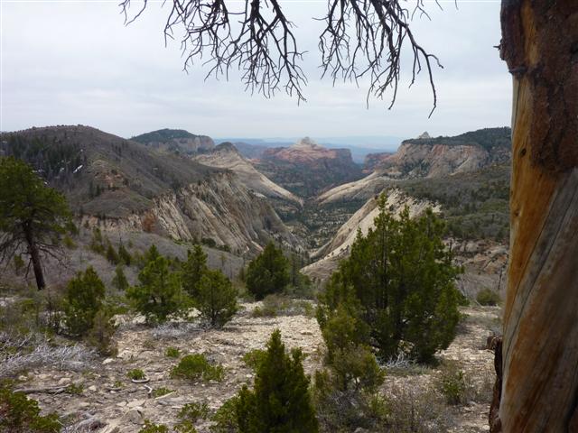
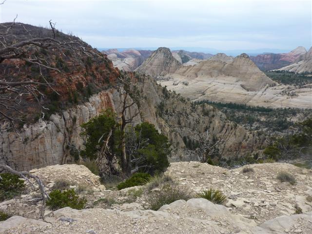
I probably stopped for about 30 minutes at the junction and saw several people pass me at this point. I really had to think of where I was going to camp tonight as I had already passed my designated site earlier in the day which was in Wildcat Canyon. I knew another guy on the trail who was staying at campsite 9 tonight and I thought I could tag along. Once on the West Rim Trail, there are nice views to the left and the right. They aren’t as extensive as the southernmost point, but they’ll make you stop to take some photos. The geology is so huge, it almost looks fake. I loved every minute of it.
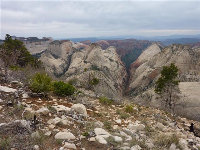
Campsite 9 came and went and I made it to campsite 8 in need of water. It was there where I met Donald, a retired computer engineer who was heading to campsite 3. We chatted briefly and he offered to have me stay at his site. A nice gesture considering I was really out of luck on where to go. The hike heads back up some switchbacks and onto a large ridge where the views become fantastic. On top of the plateu, the wind really picks up and there was rain in the forecast. I could tell it may be a nasty night. Within 10 hours I was happily arriving at campsite 3 to see Donald hanging out there. I again asked if it was OK to join him and he of course said yes.
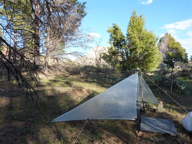
He was very interested in the gear I was using and I shared with him my philosophy. To my surprise, while Donald didn’t go quite as far as me on the UL stuff, he used a bivy aswell. I then learned he had just finished 7 days in the Grand Canyon before this trip and was heading home shortly after. It was an early night and we hit the hay at about 9pm. The wind and rain really came down that night. This was the first time I had used my N2 Tarp in weather like this and I was really nervous it was going to be damaged or blown away in the night.
Day #4 (May 18th)
Hiking Time: 5.5 hours
Distance: 10.5 km (6.5 miles)
I woke up around 7am in the morning and it was still raining.
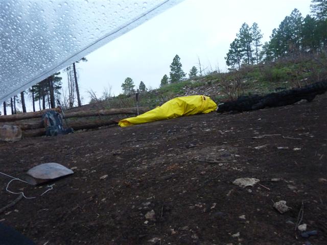
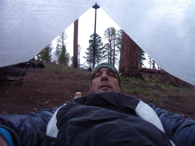
I went back to bed for about an hour and Donald woke me up as he was getting packed up. It had stopped raining by then but was still very cool and I required my down jacket to keep warm in camp. I inspected my tarp; there was nothing wrong with it and I was bone dry. I expected it to perform well, but in a storm like that I figured it would have shown some signs of wear. Nothing. I am now much more confidant to use it in similar conditions. This would be my final day.
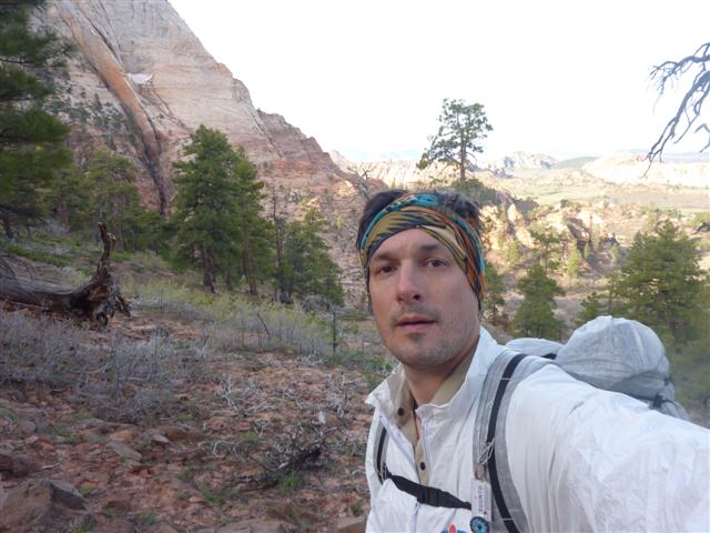
My knee had been bothering me yesterday so I was hoping it was going to be better by the morning. Within a few miles I was in full stride and feeling good. I said my good byes to Donald as he was really moving and I wanted to take photos and videos.
By the time I had Angels Landing in sight, the heat was in full effect and I was sweating like a maniac.
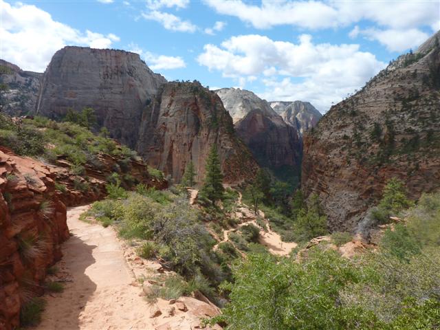
I changed in the public bathrooms located at the base and prepared for the hike up. I have to be honest, it was a bit scarier then I had thought it was going to be.
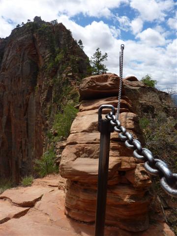
I think what psyched me out the most is that fact that there are tons of people going up and down. I even saw a girl running down and it kinda freaked me out. One wrong move and literally, you will fall to your death.
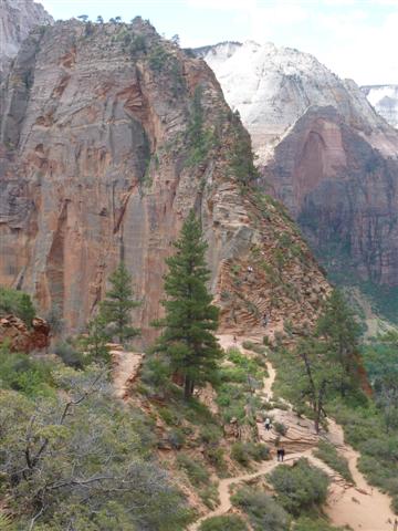
Other then that, the view from the top is mind blowing. I spent about 30 minutes up there relaxing and decided to come down.
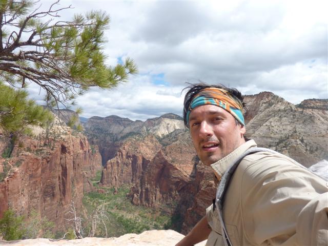
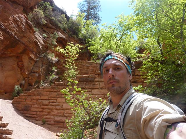
The way down is a bit easier, at least for me, and it seemed less busy so I didn’t have to wait or anything like that. Once at the bottom of Angels Falls, it’s a nice relaxing hike to the bottom, down some switchbacks and into The Grotto.
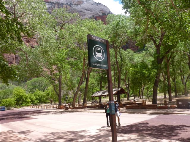
Once I got to The Grotto, I waited for the shuttle bus to come and take me back to the entrance of the park. I made sure to sit by myself as I am sure the nicely dressed tourists had better things to do then sit next to a smelly hiker.
When I did finally get to my car, I thought that I may do another quick dayhike as I didn’t have to be back in Las Vegas until the following morning. However, when I talked to the Zion Adventure people they told me that it was a little late in the day to start anything major. I agreed, got in my car and drove back to Planet Hollywood to spend the night and wait for my buddies. In the end, the hike was a blast, I loved it and I recommend it to anyone who has a chance to do it. Woohoo!