
WAKAMI LAKE PROVINCIAL PARK
Summary
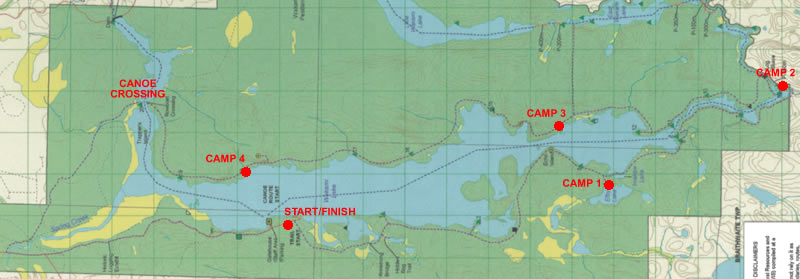
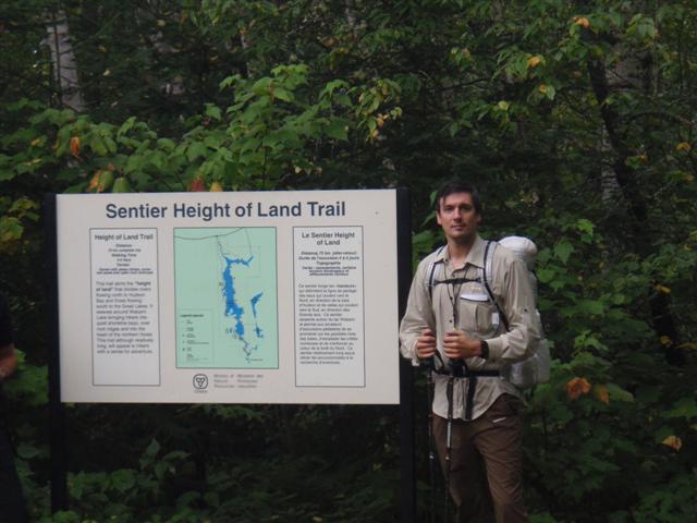
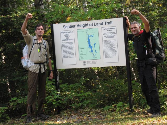
The Height of Land Trail is located in Wakami Lake Provincial Park and consists of a 75 km loop which travels along the shoreline of Wakami Lake. The west side of the trail crosses the Height Of Land which divides the Arctic and Atlantic Ocean watersheds. The terrain is somewhat rugged and the trail is quite secluded but the real difficult part of the route is the off trail travel. The trail itself has seen very minimal use and in fact the rangers told us that we were the first to complete the whole trail this year. Also, the trail is not maintained all the way around so various sections are extremely difficult to follow and off trail travel is required for extended periods of time. Following the trail is simplified by the fact that you just have to walk around the lake so you always have a point of reference, but I would only recommend this trail if you are comfortable traveling off trail without the assistance of trail markers.
Day #1 (Sep 7th)
Hiking Time: 0 hours
Distance: 0 km (0 miles)
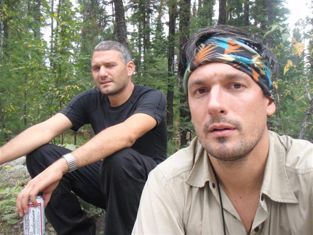
It was an early morning, getting up at 6am in order to grab Jason and hit the road as soon as possible. We knew we had a long drive ahead of us and the fact that I left my map at home didn’t help either. You probably don’t want to hear about 2 guys driving for 12 hours, so I’ll skip right to the good stuff…about 12 hours later and 934 km, we pulled into Wakami Lake Provincial Park. It was already dark and the ranger station was closed for the night. It was too late to start hiking, so we drove around in the park until we found a free campsite on the lake to set up for the night. After such a long day, we decided that setting up camp wasn’t going to happen, so we just slept in the back of the truck.
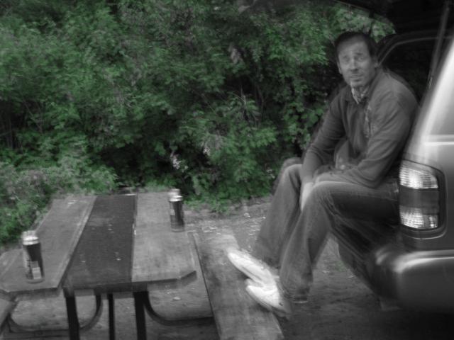
Luckily for us we stopped and picked up a few beers to have before bed. Just before crashing out, one of the campers down the road came over to warn us of a bear that had been in the area and was bothering some of the campers. We thanked him and thought nothing of it. It was off to bed by 11pm.
Day #2 (Sep 8th)
Hiking Time: 7 hours
Distance: 15.5 km (9.6 miles)
Have you ever slept with your buddy in the back of a Nissan Pathfinder? A little advice, don’t do it. This was a seriously uncomfortable sleep. I was too tall to stretch out and I thought my legs were going to break, Jay had an equally uncomfortable time. But we were up by 8am and getting ready to start hiking. We drove back to the ranger station to pick up our permits and found that the bear trap was occupied by a big black bear. The rangers told us this was the one causing the problems and they were going to relocate it 80 km away.
With the permits in hand, the rangers gave us the key to the canoe that they leave for us on day 4 in order to cross the lake. Then, it was back to the car to head to the end of the trail and stash a couple of beers so that the last part of the trail, which follows a road, can be somewhat enjoyable! Then it was off to the trailhead.
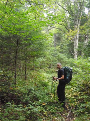
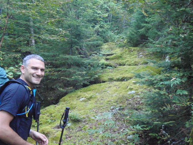
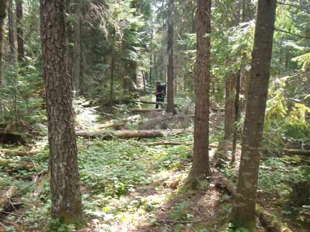
After the first km, we realized that this trail wasn’t used much. The overgrowth was pretty hairy and it really didn’t let up during the first day. There were trail markers here and there, but a compass was definitely required.
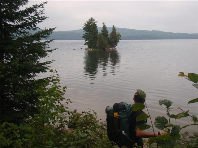
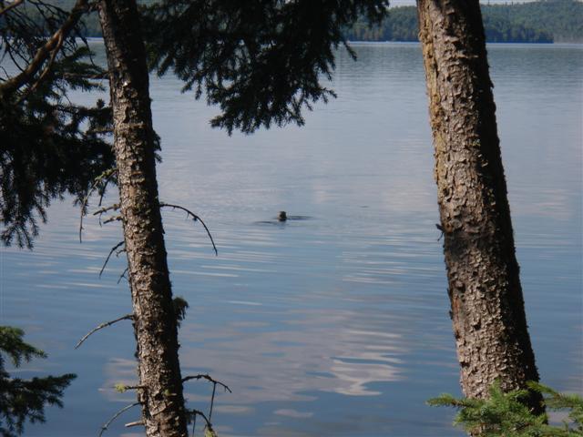
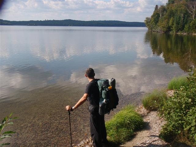
The trail really hugs the edge of Wakami Lake for the first part and it gives nice views of the lake. At times, I think we were following game trails but as long as every once in a while it spit us out to give a glimpse of the lake, then we knew we were traveling in the general correct direction.
We thought we were making pretty good time so we headed out to a the peninsula to have lunch. It was a bit overcast but the rain held off. It was nice to have a picnic table on the beach for lunch, not sure where it came from but we didn’t complain.
After lunch, it was a few more hours of bushwhacking before getting to the campsite. Truthfully, we got completely lost at one point and walked around for a while trying to locate the trail. When we finally did, we couldn’t understand how we had gotten so far off track.
When we had told the rangers that we were planning to stay on Efby Lake on the first night, he said it was going to be beautiful…so when we arrived and saw 3 boats sitting on the tent sites and the amount of garbage on the site, I was in denial and didn’t believe this was the site. I told Jay I was going to paddle around in the lake in one of the boats as I suspected we had gone off the trail and ended up at a picnic site or something – maybe the campsite was somewhere else?.
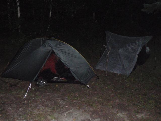
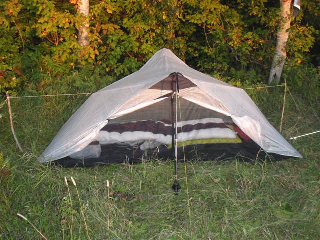
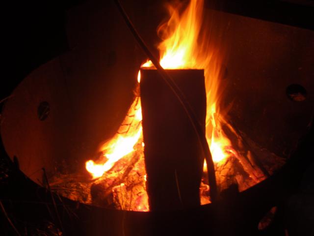
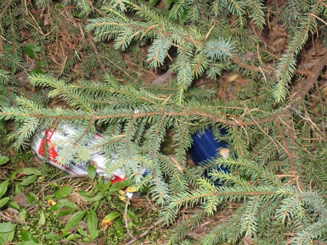
After a quick paddle around the lake, I verified with the map that we were in fact at the campsite and believe me, there was no other place to set up or else we would have used it. We moved the boats over to one side and pitched our tents on the other side. We started a fire and burned all the garbage at the site. It actually would have been pretty comfortable except that the entire site was on an angle which caused us to slide into the corners of our tent. After we hung the bear bag, it was straight to bed for us.
Day #3 (Sep 9th)
Hiking Time: 7.5 hours
Distance: 11 km (6.8 miles)
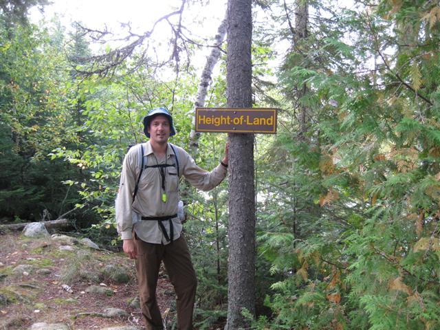
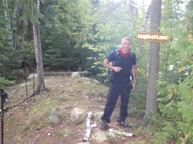
The night was pleasant with no wind and nice temperatures. We slept well and were up and about by 9am. A quick granola bar for breakfast and we were on the trail. We were a bit nervous about finding the trail as the day before we had gone off track quite a bit and we missed where the cutoff was to continue. A few hundred meters back and we saw where we missed it, and before long we had reached the Height Of Land. Hard to imagine that this relatively humble piece of land is where the waters split to the Arctic and Atlantic oceans.
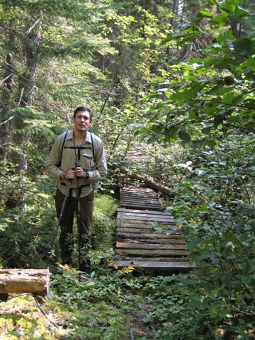
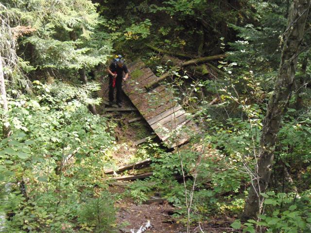
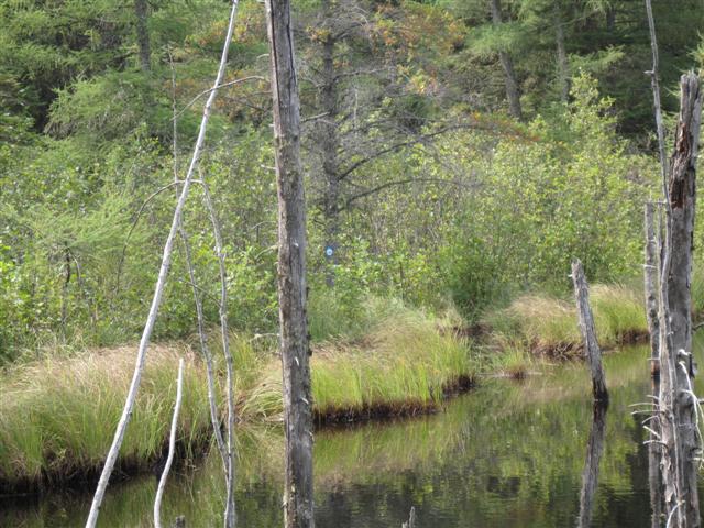
The hiking here was quite easy as it seemed the trail had actually seen some usage in the past years. No doubt due to the popularity of this particular area. Didn’t bother us, we were glad to have a bushwhack free hike. The fun didn’t last very long however. We came across a dilapidated bridge crossing a bog with some major off trail travel following.
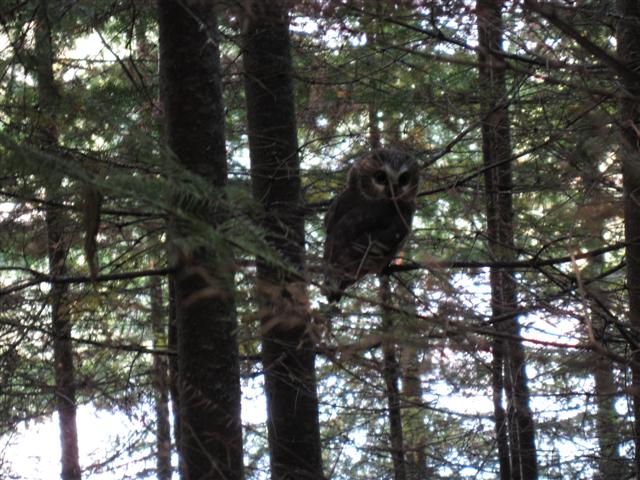
This is where things got a little messy…after the bridge, the trail seemed to head north, so we automatically assumed that we had passed the southern tip of the trail and headed north. As we hiked in the assumed northern direction, we came across a small owl sitting on a low branch. This was a great photo opportunity.
It was not clear to us that we had made a terrible assumption. We spent the rest of the day following game trails and bushwhacking with the odd trail marker leading us on. There really is no record of where we went that day, or how we got there, but later in the evening we came across a marked campsite. The first we had seen in about 5 hours. Looking at the map, we tried to calculate how far we had hiked and where we were by looking at the landmarks. I came up with the great theory that we had skipped campsites 7 to 12 due to our bushwhacking and were now at campsite 13. This would leave us 2 very easy days to complete the trail. However, we were actually at campsite 8 and 13 was a full day away still…but we didn’t know that!
We had a nice fire that night, chatted about our trip, and I couldn’t stop looking at the map trying to see how we had missed so many sections of the trail. Eventually, I gave up and figured we would find out exactly where we were in the morning. By 11:30 we were in our tents sleeping.
Day #4 (Sep 10th)
Hiking Time: 7.5 hours
Distance: 17 km (10.6 miles)
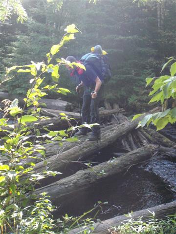
Thinking that we had made such amazing time the day before, there was no reason to get up early or to push too hard. After all, we wanted to spend 5 days on the trail so we thought today would be an easy few hours. The day started off almost immediately with losing the trail, followed by a log crossing that I thought for sure Jay was going to fall in…unfortunately, he didn’t and I only got this picture.
Other then route finding through the bush, the morning consisted of lots of pictures. We figured we had time to burn so we started to take pictures at every opportunity. By far the funniest instance was when we came across what looked like a lost backpack. Upon closer inspection, it was a camp chair with a book and a deck or cards in the pocket of it. We guessed it fell off someone’s backpack. Then, as we looked even closer, the deck of cards wasn’t just an ordinary deck…no sir…it was a nudie set of cards!
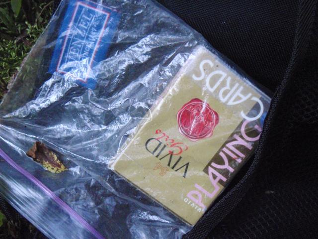
Now I realize that this may not seem funny to you, but let me tell you how hard we laughed. I couldn’t stop, it was the most ridiculous thing I had found on the trail and a picture was in needed for proof. We finally got around to continuing on, but not without continuous jokes about how lonely that hiker must have been to carry them.
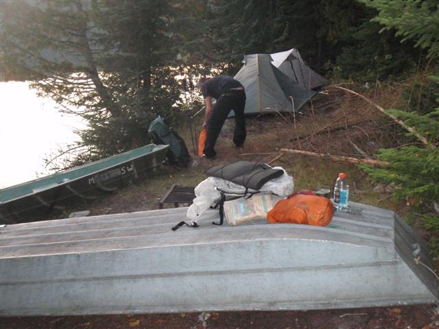
It was shortly after this point where we noticed that one of the campsites we passed had been marked with a number. One had the number 10 on it. To us, this didn’t make sense because we thought we had camped at site 13 last night. Then, after an hour or so, we came to another camp site. This one marked 11. It was now starting to make sense why we had made such good time on our second day. It was because we DIDN’T make good time!! We figured out that we camped at site 8 on the second night and now it was time get moving or else we weren’t going to finish the trail in time. Bushes, blow downs, and broken bridges…we finally made it to our campsite which we were positive was number 14.
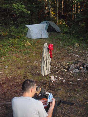
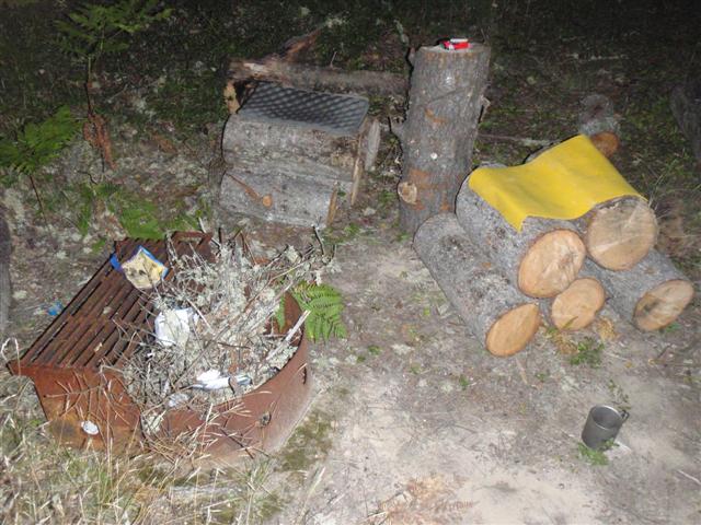
By the time we made it to camp, the sun was already dropping and we were pretty tired from pushing on the last part of the day. I guess there had been some maintenance on the site recently as it was well cleared out and there were a bunch of cut logs sitting on the site. We pitched our tents, grabbed some firewood, and built some seats out of the logs. A nice dinner and a fire ended a tiring day.
Day #5 (Sep 11th)
Hiking Time: 8.5 hours
Distance: 16 km (10 miles)
A little depressed at how we lost a bunch of time, we were up by 7am and on the trail by 8:30 or so. We wanted to make it to at least campsite 18 today in order to give us a chance to finish the trail in 5 days.
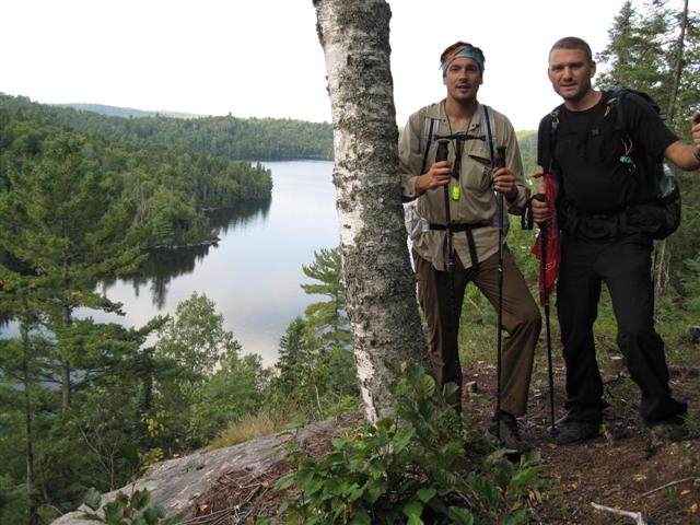
This day was the toughest with regards to terrain but the trail was somewhat easier to follow. By now we had learned how to zigzag through the bush to pick up the trail when we lost it so we would rarely be off trail for more then an hour or so. The immediate steep climb from the campsite lead to nice look out and a great photo.
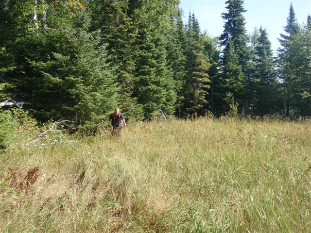
The trail follows some rolling terrain on the way down until it’s back to overgrown bush again. There were a few instances where the trail was lost, but like I said, we were getting good at finding it again. We were pushing to get to 18 today so we would have a somewhat easy 21km out the next day. At one point, we had lost the marked trail and decided to hug the lake edge until we found it again. This lead us through some mushy swamp grass.
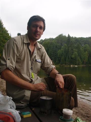
Shortly afterwards, we came to campsite 15 and decided it was a good time to stop for a bite to eat. This campsite had obviously not been used for quite some time as there were numerous blow downs on the actually campsite. It did however, have a nice lookout onto the water perfect for a rest break. I cooked up some spaghetti and meat sauce while an 2 otters swam by to see what all the fuss was about.
We knew we had a bit of distance to cover so we filled up on energy and hit the trail. We made great time to campsite 17 and we had read that there was a great area to go for a swim. We checked it out but the actually site was in pretty bad shape. Seemed that almost all the campsites were in bad shape and in a heavily forested area like this, there really isn’t many alternative options. We picked up our gear and headed off to the next one.
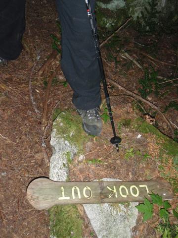
We pushed on and found ourselves coming across another lookout area. This one had a side trail going up to the lookout. The trail wasn’t noticeable and the sign was actually on the ground on the trail. I was hesitant to try and find the trail as I had visions of walking in circles so we decided it was the smarter move to just get to our site and rest up for tomorrow.
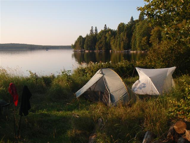
We were starting to get a bit tired, but we did finally make it to campsite 18. It was located on a small peninsula overlooking the lake. It looked as though it was used more by the fishing boats as a day site but it was a much better option that what we had already seen. This site had ample room for 2 tents, a nice picnic table and a big fire ring.
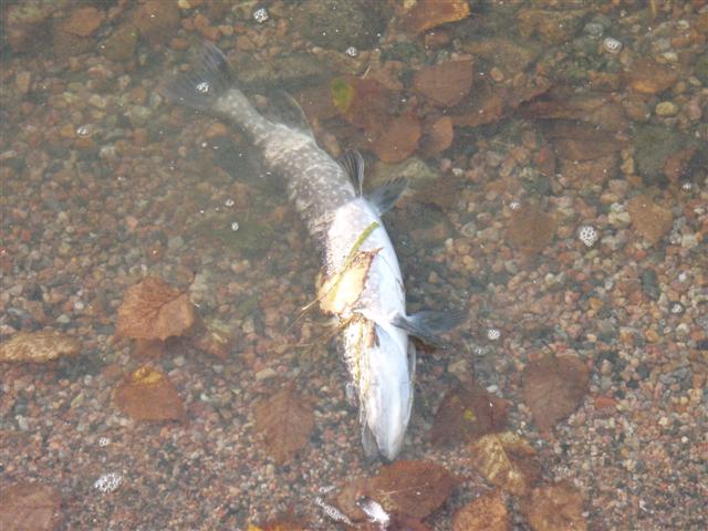
Also, there was a small beach off to the side so I decided to go for a swim. The water was stinkin’ freezing and I could barely get in past my waist. I glanced over and saw a leach squiggling it’s way over to me…that was enough to convince me to get out! We saw a dead fish by the shore and thought maybe that would attract a bear in the evening, we hung our food high and figured it was far enough away that even if a bear did come for the fish, it wouldn’t bother us.
It had been so damp that everything that was sitting around was getting soaked. I have actually never seen it so bad. All of our gear was literally wet from just sitting on the picnic table. I decided to really open up my tent in hopes of drying out the interior. It did work temporarily, but not all night.
The campsite was again littered with a bunch of wood so we were able to have a nice fire that night. I’m not sure who goes around cutting all this wood because you would need a chainsaw to get through the massive pieces. It looked like it had been there for a while so we burned a few pieces to keep warm that evening. Good thing too because with all the moisture in the air and the low temperature, we were getting chilly.
We decided to hit the hay a little earlier that night so we could get up at first light and start hiking. We had a long day ahead of us and an even longer drive to get home.
Day #6 (Sep 12th)
Hiking Time: 7 hours
Distance: 21 km (13 miles)
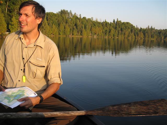
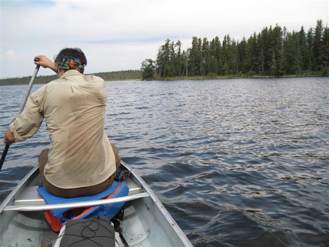
Everything was pretty much soaked with condensation this morning. Actually, every night was like this but this morning had an unusually large amount of slugs on the tent…and they were gross. By the time we were on the trail and moving, we were soaked in no time and it was a somewhat easier walk to the lake crossing where the ranger leaves the canoe for you. We loaded up the canoe with our gear and headed off for the other side of the lake. It’s a short trip, and takes only a few minutes, but I’d rather paddle then swim.
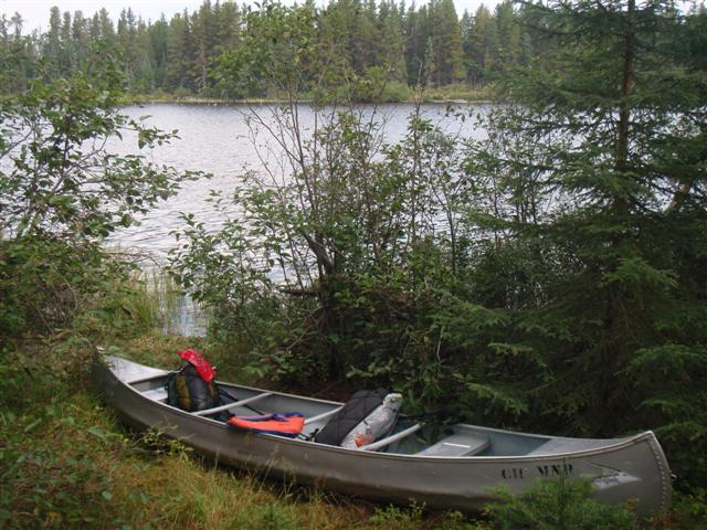
The park provides all the gear needed for the canoe and all you have to do is paddle it across, leave all the gear inside, and they come and pick it up later on. I thought it was a great little change of transportation for the brief time you are paddling.
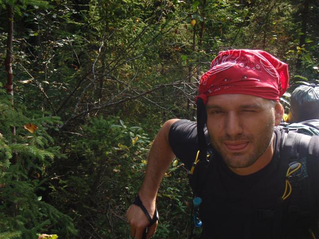
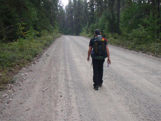
Once at the other side, we left the canoe against a tree with the gear and loaded up for the remainder of the hike. According to the map, this was an easy part of the trail as it followed an old logging road for the remainder of the trail until it hooked up with the road leading into the park. Well, I guess the map was printed decades ago because the logging road was so overgrown, we could barely hike on it. It wasn’t just bush, it was thick trees. At times, we found it easier to bushwhack beside the road then on it. Jay ended up tying his bandana on his head to protect it from all the branches that were scraping it. I think he makes a good pirate.
We ended up taking a major detour as a result of the trail being so difficult to follow. This isn’t exactly what we were hoping for on this last day, but of course, this was supposed to be an adventure! We did finally backtrack and saw where we had missed the trail marker…we could have really used a canoe here as well!
After getting back on the trail, it really ended up opening up a bit and the hiking was straight forward. We knew we were coming up on the stashed beers so we kept our eyes open for the tree we put them under. Then, it was there, the tree! Jay went around the side to see if they were still there…and they were.
We packed them up in our bags and headed for the end of the trail, only a few minutes away. Once we reached the park road, we cracked the beers and took a rest on a small bridge. As we enjoyed a drink, I glanced over my shoulder and saw a bear trot across the road. I pointed it out to Jay, but the bear was too quick and Jay missed it. I really thought we were going to see much more animals but I guess the bushwhacking was too loud to sneak up on any of them.
While we were resting, the park ranger came by who gave us the permit. He congratulated us for finishing the loop as apparently we were the first ones to do it this year. According to him, most people either turn back because of the minimal trail maintenance, or take the canoe directly back to the trail head. We told him it had been a tough but great time. Then, he asked if we enjoyed the beers he left for us? We had no idea what he was talking about. Apparently, he had left a bag with 2 beers in it at the canoe for us! I remember seeing the bag but Jay and I figured it was a bag of rocks or something to stop the life jackets from blowing away! We couldn’t believe it…we didn’t even check! Oh well, we thanked him a million times for his efforts. He was heading out to fish and offered us a ride back to the trail head, but we declined and decided to walk the remaining 7km in order to officially complete the entire trail.
About an hour later, we came to the campground sign so we knew we were getting close. By now, our legs and feet were anxiously anticipating the end of the trail and we were in rough shape.
Then, after dropping the canoe key back at the ranger station, we made it back to the car and snapped a quick photo at the trail head. Gotta have the classic trail head photo!
Well, what can I say? I had an absolute blast and so did Jay. It was tough, but what a great trail. One thing though, if you plan to hike this trail, make sure to wear some tougher pants then me, mine were ripped to shreds at the end of the trip. Now we can’t wait until our next trip!